Dataset / Geospatial
Suitability map for Avian influenza, Asia: Cartes de favorabilité à l'occurrence de grippe aviaire, Asie
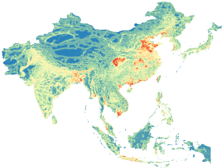

Abstract
A Spatial Multi Criteria Evaluation was applied to map a suitability index (ranging from 0: low suitability to 255: high suitability) for habitat suitability for occurrence of highly pathogenic avian influenza virus H5N1 in domestic poultry in Asia. The method developed by (Stevens et al., 2013) was applied on recent databases of poultry and human populations.
<br\>
Variables included in the study: 1) Domestic waterfowl density, 2) Chicken density,
3) Human population density, 4) Roads, 5) Water, 6) Crops.
A full description of the methodology is presented in (Stevens et al., 2013).
<br>
The present data set includes rasters (spatial resolution: ca 1 km):
<br>
- the AI suitability map <br>
- the normalized criteria <br>
<br>